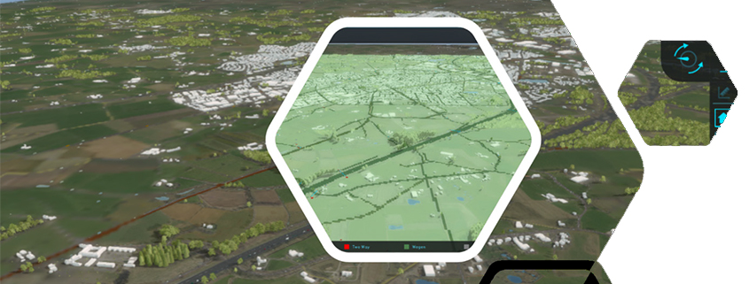
New 3D Webviewer
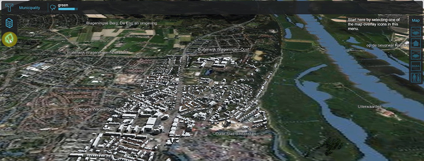
You can now select a 3D web viewer, based on Cesium, directly from the 3d web icon on the top right of the Editor interface or via Tools > Web […]
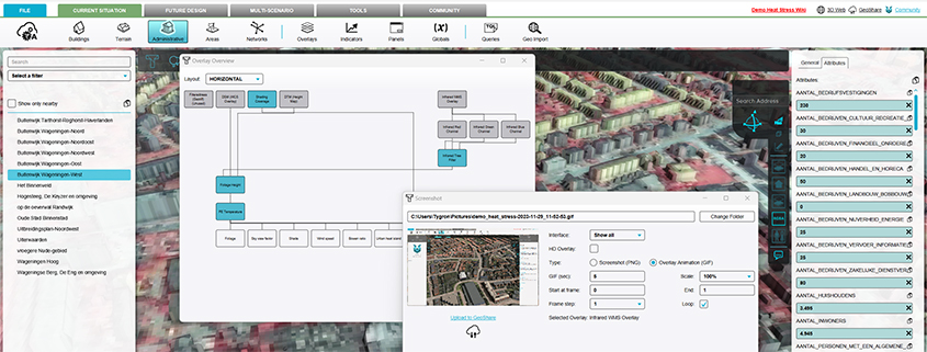
Overview panel of all relations between overlays
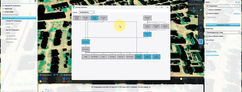
It is now possible to see an Overview of all relations between overlays. Select Current Situation > Overlays > Overview. See also: https://previewsupport.tygron.com/wiki/How_to_use_the_Overlay_Overview https://youtu.be/51RUgWHK-AEhttps://youtu.be/5v-o_ozDytY
Adding a GeoTIFF to a measure
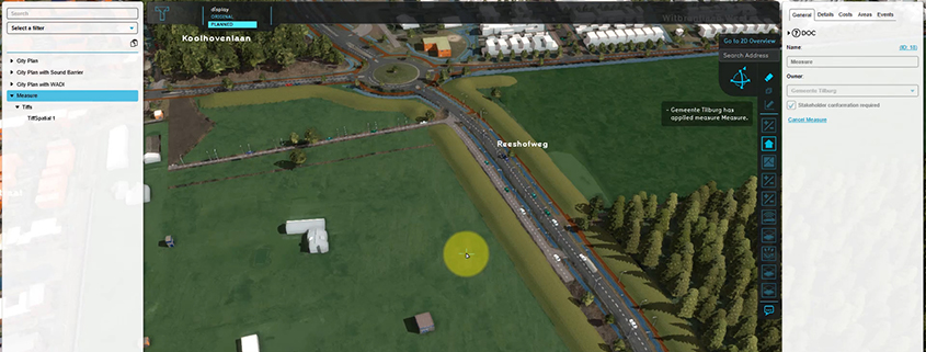
Very useful for e.g. including a new height map in a measure – for calculating the impact of an urban plan on water nuisance. Documentation: https://previewsupport.tygron.com/wiki/How_to_add_a_GeoTIFF_to_a_measure https://youtu.be/BJwq7Gm6qUI
Several security updates including direct password reset
Cyber security and protection of (personal) data are crucial in a digitized and connected world. We continuously work on updating our software security policy. Among others we have improved the […]
Better trapezium breach input for rivers
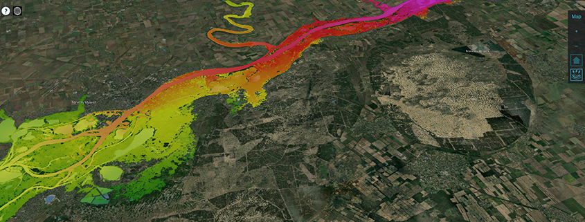
Useful for simulating large breaches such as the Khakhova dam breach. https://www.tygron.com/blog/2023/06/09/khakhova-dam-break-simulation/
Several UX improvements
TQL Panel: Better navigation for Clause menu’s. Copy-Paste functionality Fly to coordinates and timeframe WMS/WCS Overlays have timeframes, more prequels Better attribute feedback: Blue: edited value Grey: parent value […]
Ability to perform scheduled update during testrun
When creating a project with complex calculations, the calculation time may require a user to use a scheduled update rather than a direct calculation, so that it can be run […]
Select your own GPU cluster (down only)
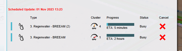
I want to be able to pick my GPU cluster in Tygron. For specific calculations with water models the biggest cluster can take significantly longer then the less extreme cluster. […]
Groundwater: calculations with conductivity and bottom distance
For improved groundwater calculations. For context and more information see: CoP-sessie-Vallei-en-Veluwe.pdf (tygron.com) Hydraulic conductivity with thickness (Water Overlay) – Tygron Preview Support Wiki Ground bottom distance m (Water Overlay) – […]
Automated extraction of project-specific data from large area datasets, with Float 32 support on Geoshare.
By supporting the new styles=float32, multiple GeoTIFF files can now be set up as a WMS/WCS overlay with multiple layers as timeframes, directly from the Geoshare. See also: https://previewsupport.tygron.com/wiki/Version_2024.3.0
