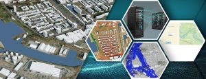
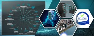
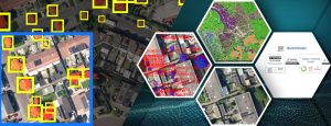
The Tygron Platform is an Open Web Platform consisting of multiple applications:
- Tygron Engine is the central cloud hosted by Tygron in the Netherlands. It contains a Supercomputer with state-of-the art parallel processing capabilities based on GPU technology. It simulates the current situation in your area of interest, as well as into the impact of future scenarios.
- Tygron Client is our own 3D visualization app that can be used to analyze the calculated results or configure your project. It is combined with the GeoShare app that can be used to easily share Spatial data withing your Organization or the Community.
- Since the Tygron Engine supports open web formats, has a documented API and Python SDK it can connect with other apps and services. For example Web Viewers, QGIS, ArcGIS Online, Dashboards, FME, Unity and many more.
Data
- Automatic connection to many public data sources.
- Supports multiple formats, like GEO web services, Vector, Raster and 3D Models.
- Share data withing your organization or the Community.
Simulation
- Multiple simulation models designed for GPU Supercomputers.
- Integrated rasterizer converts large amounts of GEO vector data into rasters and parallel query execution.
- Create or combine with you own custom simulation models.
Analysis
- Visualize output data in our complementary Tygron 3D Client.
- Query data or connected many other alternatives using Open API and GEO standards.
- GIS apps, Web viewers & dashboards or a Unity client.
Security
- Privacy by design and special purpose firewall for multi-layer security.
- Includes Account management options for User access levels or to setup Two-Factor Authentication.
Scenarios
- Simulate and predict the impacts of different development scenarios and calculate impact with Key Performance Indicators.
- Parametric Design for multiple developments.
Automation
- Add templates for fast repetitive analysis in new projects.
- Use the Tygron SDK to make the Engine part of your ecosystem of connected online services.
What our customers have to say
“The Tygron Platform enables us to automate the quantitative aspects of area assessment and allows us to focus on the process and the qualitative aspects”
Maarten Alberse
NLGreenlabel
"Due to the web-based nature of the Tygron platform and it's well-structured API I can really integrate the Tygron platform in the ecosystem of tools we have without losing data or information. This allows me to flexibly switch and use the best tool for the question at hand"
Len Geisler
Tauw
"The Tygron Platform allows me to work integrally on spatial planning in combination with related themes such as land exploitation, environmental impacts and climate adaptation."
Sander Geertzen
Sweco
https://www.youtube.com/watch?v=oGRaYW00pBw Easily import a Sketch-up model into your project, e.g. from a database such as 3D warehouse, using ArcGIS Pro…
https://www.youtube.com/watch?v=JUy-pN2OTdw Use available I3S 3D city model data to build a new project on the Tygron Platform instead of our…
https://www.youtube.com/watch?v=hUvuqEMmBdY Drag and Drop 3D Geo data: Import detailed 3D models, including textures, directly into the Tygron Platform. Documentation: https://previewsupport.tygron.com/wiki/How_to_create_a_SLPK_file
https://www.youtube.com/watch?v=_c70sufgqCM Use parametric design to create future scenarios for urban as well as rural planning and gain insight in the…
The Tygron Platform offers a large amount of geographical data, which can be accessed with a GIS via a WFS….
Tygron en ESRI hebben een innovatiesprint gedaan om beide werelden beter te integreren.