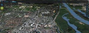
New 3D Webviewer
You can now select a 3D web viewer, based on...
Read More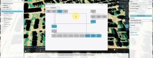
Overview panel of all relations between overlays
It is now possible to see an Overview of all...
Read More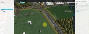
Adding a GeoTIFF to a measure
Very useful for e.g. including a new height map in...
Read More
Several security updates including direct password reset
Cyber security and protection of (personal) data are crucial in...
Read More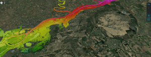
Better trapezium breach input for rivers
Useful for simulating large breaches such as the Khakhova dam...
Read More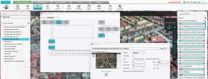
Several UX improvements
TQL Panel: Better navigation for Clause menu’s. Copy-Paste functionality Fly...
Read More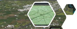
Groundwater: calculations with conductivity and bottom distance
For improved groundwater calculations. For context and more information see:...
Read More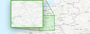
Automated extraction of project-specific data from large area datasets, with Float 32 support on Geoshare.
By supporting the new styles=float32, multiple GeoTIFF files can now...
Read More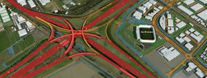
NSL intensity factor for traffic is now adjustable for templates and new projects
The NSL (Nationaal Samenwerkingsprogramma Luchtkwaliteit) factor used for traffic calculations...
Read More
Added support for Micro Relief in the water calculations.
The Water attribute FLOW_THRESHOLD can now be used as an...
Read More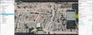
Easier handling of Overlays and Indicators
Being able to determine the sequence of indicators themselves. You...
Read More
Prequel Water Overlays with themselves
You can now also prequel water overlays with themselves, and...
Read More