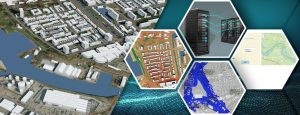
The City of Rotterdam faces a huge challenge. Many new homes need to be built. The city must remain accessible, with opportunities for business. But there is also a strong focus on nature, the climate and biodiversity. After all, nature-inclusive construction, large-scale tree-planting plans and nature restoration are high on the agenda for politicians and policymakers. But how can nature, the climate and biodiversity retain the same importance when it’s time for actual decisions to be made?
This article explains the modelling of bat networks, comprising routes, roosting sites and foraging sites. The modelling of bat networks is part of a larger ambition: an integral approach to assessing plans for housing developments and other public space interventions in relation to factors such as water, the climate, nature and biodiversity.
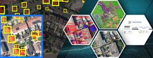
In collaboration with ecologists from the City of Rotterdam, experts from Tygron have developed a model to gain insight into bat networks1.
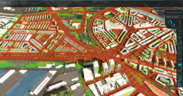
The Tygron Platform makes it possible to take an integral approach to evaluating various aspects such as the climate, the environment, housing development and the economy. It is used as an integral planning tool by water boards, municipalities, provinces, consultants and project developers.
Is it possible to model the suitability of public space for bats?
To answer this question, Tygron worked together with the City of Rotterdam. When flying through the city, bats mainly fly close to rows of trees between their roosting sites and foraging sites. Therefore, to test the functioning of a model of the bat network, we used assumptions about these three factors. This project was based on assumptions for the common pipistrelle (a widespread species of bat in the city). Other species have different, often more particular requirements. Four different videos below illustrate our approach.
1. Flight paths
Bats navigate through the city by flying close to straight lines of objects (mainly rows of trees). In consultation with ecologists from the City of Rotterdam, we drew up a number of rules that affect the flight paths of the common pipistrelle, such as:
- Average tree crown height: at least x metres tall
- Light intensity: x metres away from light sources
- Maximum distance between tree crowns: 15 metres
- Gaps in the route: no more than 50 metres
- Additionally, any gaps in the row should be at least 100 metres apart.
Click here for a demo of the flight paths:
This video explains how the flight paths were developed based on a combination of tree data and light data. The video also shows the analysis of distances between trees, which involved the use of combo overlays.
To develop the flight paths, we required data about tree locations and tree heights. These files were obtained from the source data of the City of Rotterdam and were provided in ArcGIS Online for incorporation into the project.
Details about municipal lighting locations were also provided as dot files in ArcGIS Online and entered as lighting points using Line of Sight analysis. The distance sight overlay made it possible to analyse the presence of obstacles between type of object A (e.g. a lighting point) and type of object B (e.g. a tree with a crown height of 5 metres). In other words, if a tree is out of range of the lighting, this tree is in the dark and is therefore a suitable element in bat flight paths.
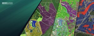
The analysis produced a map like this:
For more detailed analysis, additional information about lighting is still needed, such as the actual lux level in certain areas. This requires additional research.
2. Roosting sites
Likewise in collaboration with ecologists from the City of Rotterdam, we described a basic principle for roosting sites, namely that buildings with roof tiles, cavity walls or other dark crevices are potential roosting sites for bats. Because no data was available about the presence of bats in the area, we instead created a computational rule to consider building information from the digital cadastral map of the Netherlands (BGT). Based on building type and year of construction, it’s possible to dynamically determine which structures are potential roosts.
Click here for a demo of identifying roosting sites in buildings:
3. Foraging sites
Foraging sites are mainly insect-rich green spaces (parks, bodies of water, smaller tree groups, biodiverse gardens, etc.). Because this is still a principle rather than a rigid definition, we once again drew up a computational rule for this to determine where these elements come together. This makes it possible to dynamically determine where potential foraging areas could be found based on this aspect.
Click here for a demo of the mapping of foraging sites:
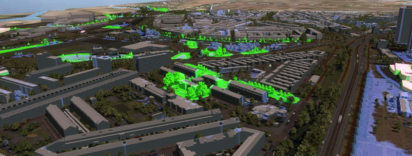
4. Bat network
When combined, the three aspects above provide insight into the bat network – not only potentially suitable routes for bats, but also whether they actually connect the kinds of sites that bats need. Moreover, the sum of all these elements provides insight into where the opportunities lie, where the network is suboptimal and where additional measures could add value for bats:
Conclusion
The videos above illustrate part of a project by the City of Rotterdam on the Tygron Platform. Besides much of the data that is processed in a Tygron project as standard, a large volume of additional data from the City of Rotterdam was processed, including:
- 3D building data from https://www.3drotterdam.nl
- Tree data from the City of Rotterdam
- Cables, pipelines and sewers
The rules listed here are general rules to test the functioning of a model of the bat network. Because of the high dependence on interacting circumstances, these rules alone are unlikely to be enough to fully determine the functionality of bat flight paths. Moreover, the analysis indicates little about the suitability of the public space for other species.
Modelling the bat network enables steps to be taken to analyse and improve these networks in the city.
We are very grateful to the City of Rotterdam for allowing us to share these insights with other users. We hope that this information will inspire other users, not only in terms of how species can be modelled, but also to share knowledge with each other.
1 In collaboration with 3DRotterdam, Rotterdams Weerwoord and ecologists