Updated visualisation of trees
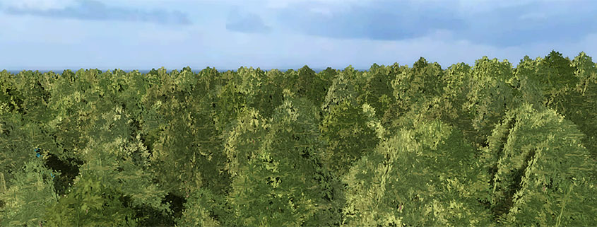
A more realistic visualisation of different tree species
WMS for GeoShare
Supporting WMS in the Tygron Platform GeoShare will add more possibilities for sharing data with the Tygron Platform and with others.
Improved 3D Coordinates Networks

Networks are now fully registered with 3D Coordinates, and the API also shows 3D Coordinates for network nodes.
Scenarios
You can now switch between Scenarios during a test run, directly from the Ribbon bar. This makes it possible to compare different solutions/ plans without having to exit a test run […]
Improved Measure Editing
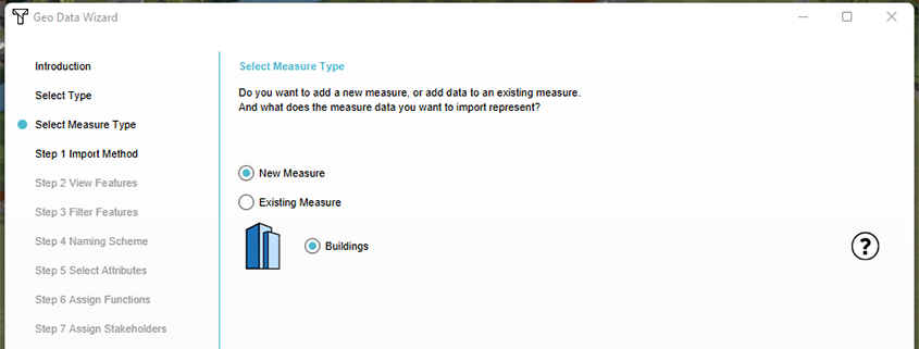
Measures can now also include a GeoTIFF, and the Geo Import Wizard allows for adding buildings to already existing Measures
Dynamic Weir
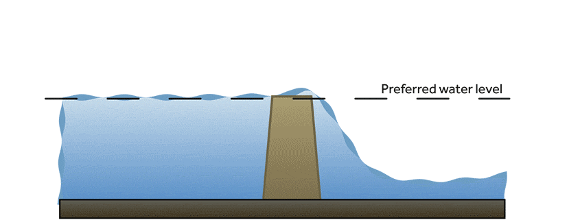
Added a weir drop water level threshold, making weirs respond more dynamically.
Password management/ force minimum number of characters
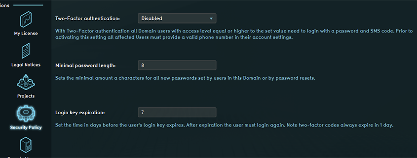
Domain Admins can force a minimum amount of characters in new passwords. Related documentation: Account management – Tygron Preview Support Wiki
2-Factor authentication
Domain Admins can now set two-factor authentication per user level. This adds an extra security layer to accessing the Tygron Geodesign Platform. Related documentation: Account management – Tygron Preview Support […]
Grid feedback
Provide feedback on the optimal grid size choise for different (water) calculations
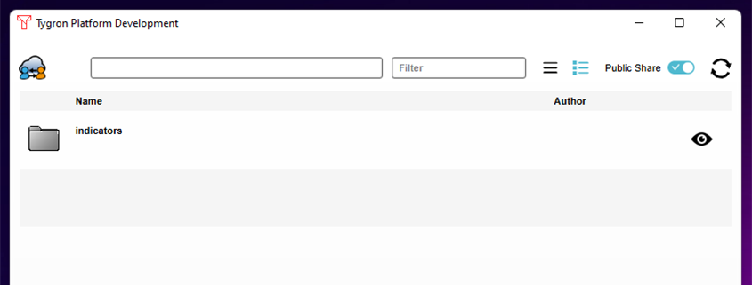
Securing indicators
Securing indicators with a ‘lock’ will enhance sharing indicators with others on the owners own terms and conditions.
