Parametric city design
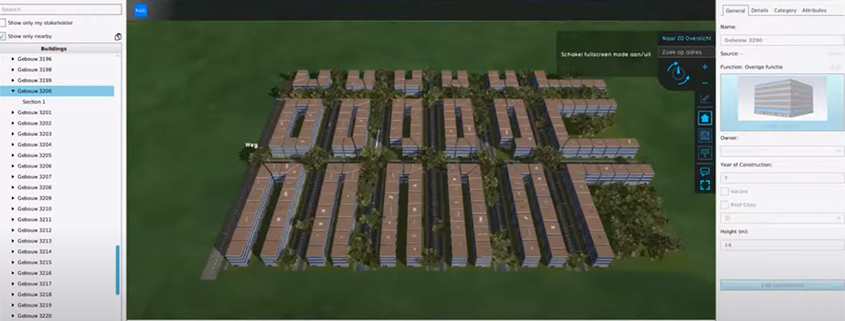
The possibility to create parametric city designs. The Tygron Platform can generate parametric city plans based on input parameters, such as building types, green, roads, parks, etc. It is possible […]
Import polygons of AREAS in the actual crs coordinates
If you’d like to add a polygon to a area using the API I have to use the local coordinates of the map. The upper-left corner is the 0,0 coordinate […]
Improvement in bridges
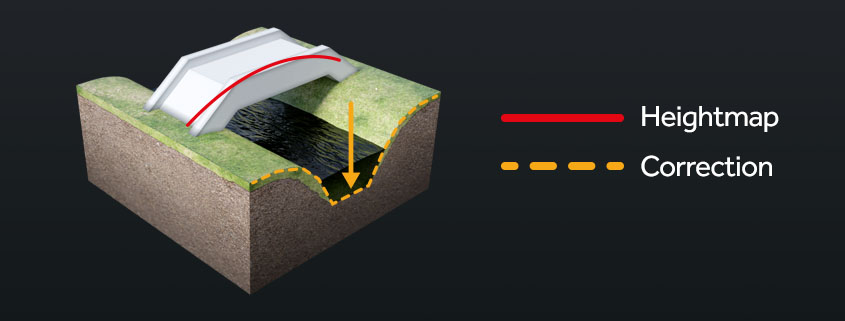
There is often a fly-in measurement error in the AHN data set under bridges. This can create bumps in the DEM and slow down the flow. A new advanced option […]
Water area visualization
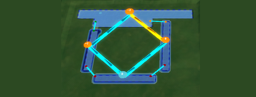
Add new water area visualization in the 3D world to provide more insight in how the water flows in a complex water system. This is useful for debugging the water […]
AHN4 support
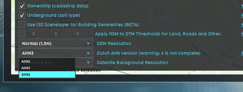
Add AHN4 support to generate projects with the most up to date height data. Note that the AHN4 is not yet available for the whole of the Netherlands. Documentation: https://support.tygron.com/wiki/Advanced_options_(New_Project_Wizard)
New flooding result types
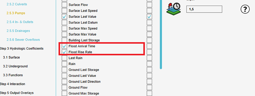
Two new result types are added: the Flood rise rate result type and the Flood arrival time. With these result types more insight in evacuation routes for flooding scenarios is […]
Button for last timeframe
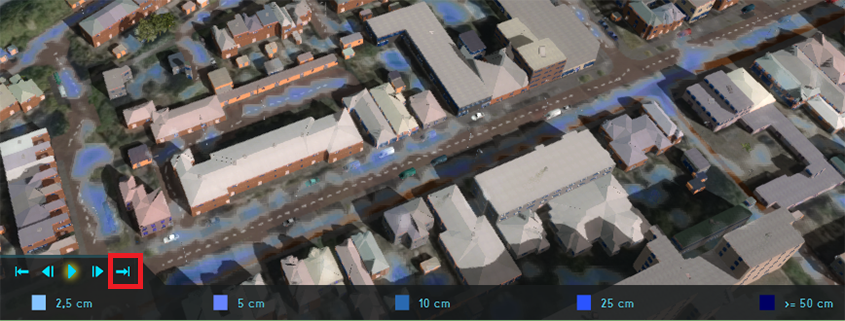
The legend bar of timeframe overlays is updated with a button to go to the last timeframe. When having created a simulation with multiple timeframes, it is useful to be […]
New Combo Overlay functions
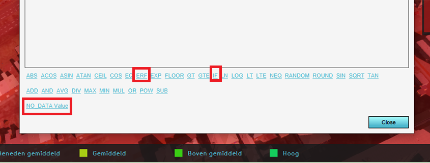
New functions are added to use in the Combo Overlay: Error functions, IF statements and support for NO_DATA. This will help to more easily create complex formulas for the Combo […]
GIF creator
Functionality to create a GIF from an overlay with timeframes, such as the Rainfall Overlay. This provides new possibilities for sharing simulations, next to the already available functionality for screenshots […]
Underground parking garages
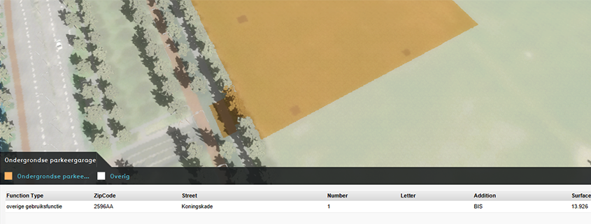
Improved detection of underground parking garages from open data to let the Platform automatically generate an even more accurate 3D world. Documentation: https://support.tygron.com/wiki/Underground_visualization