Webinar "Accelerated Simulations for Engineers." | June 13 2024 3.00 - 4.00 pm (CET)

Side view of a river water level

1
3 years ago
waterschap_aa_en_maas
Open0

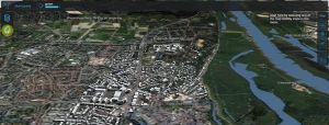
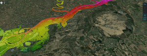
Making a side view of the water level of a river. In that way you can easily see the effect of objects (such as weirs) on the water level in the river. Ideally, you would also be able to see the bottom of the river and the ground level in the same side view. In the current version you can only make side views with a straight line (measuring tool). So, the wish is to have a measuring tool that can make bends.

Related posts

Weekly Tutorial

Privacy Preferences
When you visit our website, it may store information through your browser from specific services, usually in form of cookies. Here you can change your privacy preferences. Please note that blocking some types of cookies may impact your experience on our website and the services we offer.