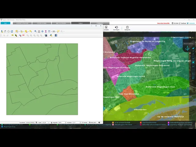
The Tygron Support team often receives the question: we already have GIS software, why should we use the Tygron Platform? In this article, we describe the differences, overlaps, and complementarities between regular GIS software, such as ArcGIS Pro or QGIS, and the Tygron Platform.

Digital transformation
GIS Software Applications
GIS software applications are designed for collecting, managing, analyzing, and visualizing geographic data. They provide a platform for working with spatial information in various forms, such as maps, aerial photographs, satellite imagery, and spatial datasets.
Functions of GIS Systems
Data Management:
Collecting and storing geographic data.
Managing data layers such as roads, rivers, vegetation, etc.
Data Analysis Methods:
Overlay Analysis: Combines multiple data layers to identify spatial relationships.
Buffer Analysis: Creates zones around objects, for example, for impact analysis around a river.
Network Analysis: Studies connectivity and routes within a network, such as roads and pipelines.
Visualization:
Presenting data in map form, charts, and 3D models.
Enhancing insight into spatial patterns and relationships.
Some examples of applications include:
Traffic Management: Optimizing traffic flows and identifying bottlenecks through analysis of traffic data and accident locations.
Utility Management: Locating and managing infrastructure such as water pipes, electricity networks, and sewage systems.
Location Analysis for Businesses: Determining the best location for stores or offices by analyzing demographic data and accessibility.
Environmental Pollution Monitoring: Mapping and analyzing air and water pollution to identify hotspots and plan measures.
The Tygron Platform: Advanced GIS-Based Modeling
The Tygron Platform is designed for performing advanced analyses and scenario calculations based on GIS. It provides the capabilities to create and analyze models that simulate real-world processes and phenomena. It integrates spatial data with analytical techniques to make predictions and test scenarios.
Features of the Tygron Platform based on GIS
Spatial Data Integration:
Combines different types of data to create complex models.
Modeling Methods:
Deterministic Models: These models predict outcomes based on fixed input parameters, such as for flooding, drought, noise, and particulate matter.
Combined GIS Analyses: Such as combining connectivity and routes with heat stress analyses for distance-to-coolness calculations and combining flooding with evacuation routes.
Spatial Excel Calculation Models: Makes Excel calculation models spatial through automated data retrieval from projects, such as flood areas, flood duration, and combining damages.
Scenario Analysis and Simulation:
Testing different scenarios to predict future outcomes, such as the effects of climate change.
Calculating housing development plans and directly analyzing their effects.
Visualization:
Use of maps, 3D models, and charts to present model results.
Some examples of applications include:
Water Management: Modeling floods, planning evacuations.
Urban Planning: Calculating scenarios and testing urban design plans.
Climate Adaptation: Predicting floods, droughts, heat stress, and performing impact analyses.
Nature-Inclusive Building: Performing calculations on biodiversity, nature, and the connectivity of green spaces.
Differences between GIS software and the Tygron Platform
Functionality:
GIS systems: Focused on managing and analyzing geographic data.
Tygron Platform: Uses GIS data to create predictive models and simulate scenarios.
Goal:
GIS systems: Visualize data and perform simple analyses.
Tygron Platform: Generates insights by modeling complex processes and interactions.
Complementarity between GIS Software and the Tygron Platform
Foundation for Modeling: GIS software provides the tools for collecting, storing, and managing spatial data, which forms an essential foundation for GIS-based modeling by the Tygron Platform.
Data Integration: The Tygron Platform uses GIS systems for data input. It supports open web formats (such as WMS, WFS, WCS), a documented API and Python SDK, enabling integration with other applications and services, such as Web Viewers, QGIS, ArcGIS Online, Dashboards, FME, Unity, and Cesium.
Collaboration and Visualization: Tygron integrates easily, also 'live', with tools like QGIS and ArcGIS Online for seamless collaboration and visualization. This offers users advanced capabilities for scenario analysis and data interpretation.
Watch here how to get data from QGIS into your Tygron project:
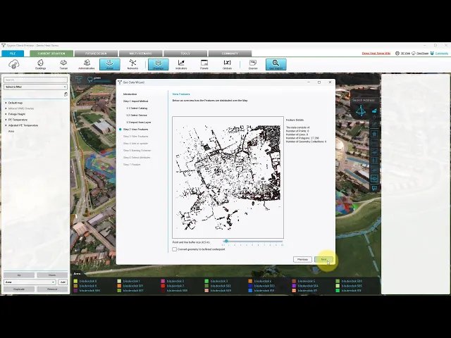
Watch here how to get data from ArcGIS Online into your Tygron project:Watch here how to get data from ArcGIS Online into your Tygron project:
Technology of the Tygron Platform
The technology behind the Tygron Platform makes it possible to integrate, simulate, and present data. Engineers need advanced tools to manage the complexity and scale of today's projects. That is why we developed the Tygron Platform – a powerful, low-code solution designed for engineers to integrate data, run simulations, and create presentations with unprecedented precision and simplicity.
Discover the three technological drivers behind the Tygron Platform that offer speed and accuracy when handling your data and simulations:
GPU-Driven Simulations: Run complex simulations in parallel using advanced cloud-based GPU technology.
Open Standards & Interoperability: Seamlessly integrate with your preferred tools to improve collaboration.
GIS-Based Modeling: Quickly build detailed projects and simulations from your source data.

